Wednesday, January 11, 2012
Wednesday, June 29, 2011
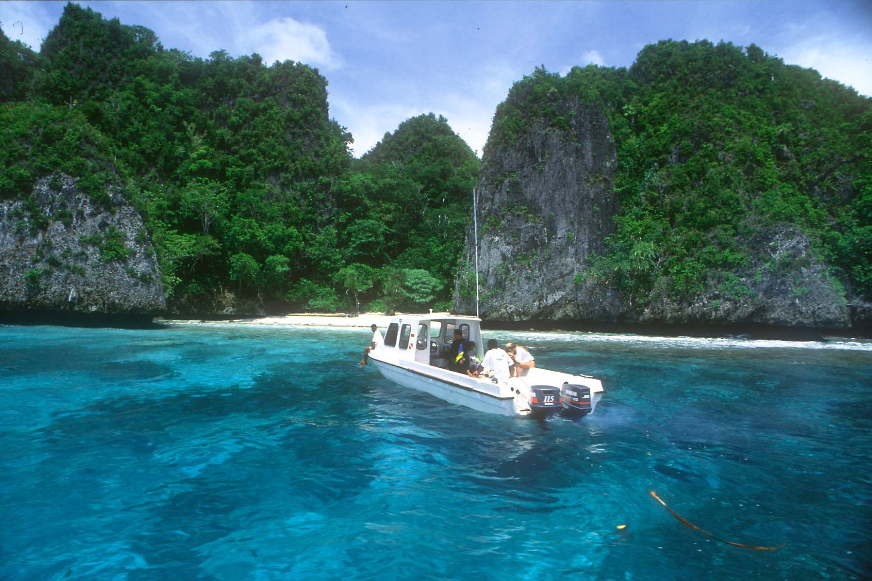
Raja Ampat Islands
Located off the northwest tip of Bird's Head Peninsula on the island of New Guinea, in Indonesia's West Papua province, Raja Ampat, or the Four Kings, is an archipelago comprising over 1,500 small islands, cays and shoals surrounding the four main islands of Misool, Salawati, Batanta and Waigeo, and the smaller island of Kofiau. Raja Ampat is new regency which separated from Sorong regency at 2004. It encompasses more than 40,000 km² of land and sea, which also contains Cenderawasih Bay, the largest marine national park in Indonesia. It is a part of the newly named West Papua (province) of Indonesia which was formerly Irian Jaya. The islands are the most northern pieces of land in the Australian continent.

According to Conservation International, marine surveys suggest that the marine life diversity in the Raja Ampat area is the highest recorded on Earth. Diversity is considerably greater than any other area sampled in the Coral Triangle composed of Indonesia, Philippines and Papua New Guinea. The Coral Triangle is the heart of the world's coral reef biodiversity, making Raja Ampat quite possibly the richest coral reef ecosystems in the world.
The area's massive coral colonies along with relatively high sea surface temperatures, also suggest that its reefs may be relatively resistant to threats like coral bleaching and coral disease, which now jeopardize the survival of other coral ecosystems around the world. The Raja Ampat islands are remote and relatively undisturbed by humans.

Marine tourism, as a sustainable alternative to overfishing, mining, and logging, has the potential to play a key role in the conservation of Raja Ampat’s spectacular underwater realm, while also creating real benefits for the local communities. This website was designed as part of a larger effort to support the growth of sustainable marine tourism in Raja Ampat and the conservation of these magical islands.
Please explore this site to find information on breathtaking diving opportunities, travel logistics, Raja Ampat’s new tourism entrance fee (which directly supports conservation and community development), and the tremendous conservation effort taking place in Raja Ampat.


The high marine diversity in Raja Ampat is strongly influenced by its position between the Indian and Pacific Oceans, as coral and fish larvae are more easily shared between the two oceans. Raja Ampat's coral diversity, resilience, and role as a source for larval dispersal make it a global priority for marine protection.
1,309 fish species, 537 coral species (a remarkable 96% of all scleractinia recorded from Indonesia are likely to occur in these islands), and 699 mollusk species, the variety of marine life is staggering. Some areas boast enormous schools of fish and regular sightings of sharks, such as wobbegongs.
The easiest way to get to Raja Ampat is to fly to Sorong via Jakarta or Singapore. Domestic travelers can also fly via Makassar or Manado.
Monday, January 3, 2011
Maui Beach

The big tourist spots in Maui include the Hāna Highway, Haleakalā National Park, and Lahaina.
The Hāna Highway runs along the east coast of Maui, curving around many mountains and passing by black sand beaches and waterfalls. Haleakalā National Park is home to Haleakalā, a dormant volcano. Lahaina is one of the main attractions on the island with an entire street of shops and restaurants which lead to a wharf where many set out for a sunset cruise or whale watching journey. Snorkeling can be done at almost any beach along the Maui coast.
The main tourist areas are West Maui (Kāʻanapali, Lahaina, Nāpili-Honokōwai, Kahana, Napili, Kapalua), and South Maui (Kīhei, Wailea-Mākena). The main port of call for cruise ships is located in Kahului. A smaller port can be found in Maʻalaea Harbor located between Lahaina and Kihei.
Maui County welcomed 2,207,826 tourists in 2004 rising to 2,639,929 in 2007 with total tourist expenditures north of US$3.5 billion for the Island of Maui alone. While the island of Oʻahu is most popular with Japanese tourists, the Island of Maui appeals to visitors mostly from the U.S. mainland and Canada: in 2005, there were 2,003,492 domestic arrivals on the island, compared to 260,184 international arrivals.
While winning many travel industry awards as Best Island In The World in recent years concerns have been raised by locals and environmentalists about the overdevelopment of Maui. A number of activist groups, including Save Makena have gone as far as taking the government to court to protect the rights of local citizens.
Throughout 2008 Maui suffered a major loss in tourism compounded by the spring bankruptcies of Aloha Airlines and ATA Airlines. The pullout in May of the second of three Norwegian Cruise Line ships also hurt. Pacific Business News reported a $166 million loss in revenue for Maui tourism businesses.
Three airports provide scheduled air service to Maui:
- Hana Airport in eastern Maui
- Kahului Airport in central Maui
- Kapalua Airport in western Maui


